Beverly Brackenbury Beach and
Landing Right-of-way to
water over sandy beach at
end of Brackenbury Lane. No
parking.
Dane Street Beach (Lyons
Park) Park with rocky shore
and sandy beach, restrooms,
benches, playground, and
sports fields. Parking lot.
Independence Park Sandy
beach with breakwater,
seawall, and grassy area
with benches. Street
parking.
Lynch Park Park along rocky
shore and sandy beach with
visitor center, restrooms,
benches, picnic table, food
concession, playground,
sports fields, and
stage/bandshell. Large
parking lot on Ober Street.
Mingo Beach Landing Rocky
shore along Route 127 with
scenic view. No parking.
Prince Street Landing
Right-of-way and boat
launching area on sandy
beach at end of Prince
Street. No parking. Public
Ways off Lothrop Street
Several rights-of-way to
Beverly Harbor: Ocean Street
(steps to beach); Atlantic
Avenue (scenic view only);
Abbott Street (steps to
beach and benches); and
Washington Street (scenic
view, grassy area, and
benches). Street parking on
Abbott and Washington
Streets, and on Ocean Street
from October-June.
Rices Beach Right-of-way to
water over sandy beach at
end of Ober Street. No
parking.
Water Street Landing Sandy
beach with boat launching
area. Street parking.
Woodbury Street Landing
Rocky shore with sand and
pebble pockets with walkway
to Lynch Park. Located at
end of Woodbury Street.
Street parking from
November-April.
Brewer Salt Marsh and Upland
Wooded upland bordering
tidal creek and salt marsh.
No parking.
Greenwood Farm Five islands,
salt marsh, tidal creeks,
fields, wooded area,
clapboard farmhouse, and
historic First Period Paine
House. Free parking.
Herring Way Right-of-way
located between 84 and 86
Northridge Road on steep
slope to rocky shore. No
parking.
Pavilion Beach Park and
sandy beach with boat
landing area, picnic tables,
and playground. Parking lot.
Riverside Park Riverfront
park with benches and wooded
area with trails. Street
parking.
Sally Weatherall Memorial
Reservation Wooded area and
salt marsh with trails.
Access off Little Neck Road.
Limited free parking.
Includes salt marsh parcel
owned by Ipswich.
Street Landing Grassy area
with benches and a
small-boat launching area
along the Ipswich River.
Street parking on Country
Road and municipal lot
across street.
Town Wharf Riverfront park
with pier and boat ramp.
Free parking.
Allyn-Cox Reservation Salt
marsh and wooded area with
trails, ECGB headquarters,
restrooms, and bench at
clamhouse landing on Essex
River. Entrance off Route
133. Free parking.
Cogwell’s Grant Historic
farm bordering the Essex
River. Limited parking.
Conomo Point/Town Farm
Expansive salt marsh
overlooking Essex Bay.
Street and resident sticker
parking on Conomo Point
Road.
Front Beach/Conomo Point
Landing Boat launching area.
Resident sticker parking.
Main Street Town Landing
Site adjacent to Essex
shipbuilding museum with
pier, boat ramp, visitor
information booth, and
monument. Resident sticker
parking. Non-resident
parking for boat ramp
allowed behind nearby fire
station.
North Shore Salt Marshes
Expansive salt marsh. Street
parking.
Stavros Reservation Trail to
top of White’s Hill with
great view. Entrance gate on
right, immediately after
turn off onto Island Road.
Street parking.
Water Street Town Landing
Small-boat launching area.
No street parking.
Crane Memorial Reservation &
Wildlife Refuge The
1,400-acre Crane Memorial
Reservation was bequeathed
by the Crane family to The
Trustees of Reservations in
1949. The reservation’s
white, sandy, barrier beach
stretches for more than four
miles along Ipswich Bay and
is separated from the
mainland by Essex Bay and
the Essex and Ipswich River
estuaries. The reservation
includes a variety of other
habitats, including a
drumlin (known as Castle
Hill), shrub thickets,
cranberry bogs, salt marsh,
dunes, and forests
Danvers Salem Swampscott Beach Bluff Right-of-Way
Sandy beach and small park
with benches and picnic
tables. Street parking and
small paid parking lot.
Danger Beach Right-of-way to
rocky shore at end of Green
Street. Limited street
parking.
Forest River Conservation
Area Forested areas with
trails along tidal creek
with salt marsh. Parking
available in Salem State
College South Campus parking
lot.
Forest River Park Large park
bordering Salem Harbor with
sandy beach and rocky shore,
restrooms, benches, picnic
tables, playground, sports
fields, pool, tennis courts,
and basketball court. Large
parking lot.
Gerry Playground (Stramski
Beach) Grassy park with
storage area for small boats
(with permit), small-boat
launching area, benches,
picnic tables, grills, and
playground. Access via
Stramski Way off West Shore
Drive. Resident sticker
parking lot.
Glendale Cove Beach Seawall
with steps to small sand and
pebble beach. No parking.
Goldthwait Reservation Salt
marsh with walkways to
Devereux Beach. Access via
Goldthwait Road. Resident
only parking lot. Street
parking except weekends and
holidays.
Johnson Park/Whales Beach
Sandy beach and grassy park.
No parking.
Juniper Beach Sandy beach
and rocky shore with boat
launching area, grassy area
with benches, and
playground. Located on Beach
Avenue, off Columbus Avenue.
Small parking lots and
street parking.
Leach Street Extension
Walkway along seawall with
benches. Limited street
parking.
Palmer Cove Park on Palmer
Cove with seawall, benches,
playground (at Saltonstall
School), and sports fields.
Small parking lot.
Palmer Pond Conservation
area with salt marsh and
small pond. Street parking
from October-May (resident
sticker parking year round).
Phillips Beach Right-of-way
at the end of Ocean Avenue
to sand and pebble beach.
Street parking from
November-April (resident
sticker parking year round).
Polisson Park Sandy beach
and grassy park with
benches. No parking.
Salem Maritime National
Historical Site Historic
Derby Wharf on Salem Harbor
with grassy park, pier,
walkway, lighthouse, visitor
center, restrooms, benches,
and picnic tables. Site of
“Friendship” replica of 18th
century square rigger. Next
to Pickering Wharf with
restaurants and gift shops.
Street parking.
Salem Willows Park with
rocky shore, sandy beach,
trails, restrooms, picnic
tables, food concession,
playground, sports fields,
and stage/band shell. Free
parking.
Sandy Beach Small sandy
beach with benches. Located
on Martin Way off Puritan
Road. Limited resident
sticker parking.
Village Street Recreation
Area Public pier and dock
with benches. Parking lot.
Waterside Cemetery Cemetery
along rocky shore with
scenic water views.
Winter Island/Waikiki Beach
Park with rocky shore, sandy
beach, pier, boat ramp,
visitor center, restrooms,
picnic tables, food
concession, playground, and
trailer camping sites. Free
parking with admission.
Wyman Woods Wooded area with
a right-of-way along
abandoned railroad track
with views of Salem Harbor.
Entrances on Route 114 and
West Shore Drive. Limited
street parking on Route 114.
The following sites are
accessible by water only:
Great Haste Island, Jeggle
Island, Ram Island.
Collins Cove Playground and
Walkway Promenade along
Collins Cove leading to
sandy beach, benches, picnic
tables, playground, sports
fields, and tennis courts.
Street parking.
Draper’s Point Public boat
launch and landing off
McPherson Drive. Access
through Bass Haven Yacht
Club.
Furlong Park Urban
riverfront park with picnic
tables, benches, playground,
sports fields, basketball
court, and tennis court.
Street parking.
Innocenti Park Park
bordering Bass River with
benches, picnic tables,
sports fields, skateboard
park, and YMCA center. Small
parking lot.
John George Park Sandy
riverfront beach and grassy
area with bathhouse and
playground. Street parking
and parking lot.
McCabe Park and Kernwood
Marina Riverside park and
marina with pier. Parking
lot.
Obear Park Park bordering
the Danvers River with
pebble beach, rocky shore,
restrooms, benches,
playground, and tennis
court. Parking lot.
Pleasant View Park at mouth
of Bass River with benches,
playground, and sports
fields. Access to boat
launching area and sand and
pebble beach at end of
Porter Street. Street
parking.
Pope’s Landing Public
landing on Danvers River
with pier, boat ramp, boat
slips, restrooms, and
benches. Large parking lot
for cars and trailers.
Gloucester Boynton Island/Long Wharf
Landing Long causeway
through tidal estuary with
extensive salt marsh, boat
ramp, and large bulkhead.
Parking lot.
Brisson and Curtis Salt
Marshes Salt marshes.
Private road access only.
Brown's Mill Landing
Extensive mudflats and
grassy area with boat ramp
(usable at high tide only),
benches, and monument. Small
parking lot on east side of
causeway.
Corliss Landing Small beach
and boat landing area along
rocky shore with boat ramp,
benches, and picnic table.
Parking lot at end of Apple
Street.
Goose Cove Rocky shore, salt
marsh, and wooded area with
trails. Small parking lot.
Gordon Thomas Park
Harbor-front park with
benches. Street parking.
Head of Lobster Cove Landing
Small-boat launching area
and small grassy area.
Access and limited parking
on Leonard Street.
Hodgkins Cove Landing Small
basin with boat ramp. Access
via stairway off Washington
Street. Street parking.
Kents Cove Landing Salt
marsh with landing for small
boats at high tide only.
Located at the intersection
of Concord Street and
Landing Road. No parking.
Lanes Cove Landing Protected
boat basin, mud flats at low
tide, pier, and boat ramps.
Small parking lot.
Lobster Cove Landing Pier,
boat landing area, seawall,
and long footbridge spanning
Lobster Cove. Limited street
parking on Bridgewater
Street on both ends of
footbridge.
Memorial Woods Wooded area
bordering Lobster Cove.
Small pull-off area for
parking across Washington
Street.
Mt. Adnah Cemetery Historic
cemetery with views of
Lobster Cove. Limited street
parking.
Plum Cove Beach & Landing
Sandy beach, rocky shore,
and park with boat launching
area, benches, playground,
and sports fields. Resident
sticker parking.
Ralph O'Maley Middle School
Middle school with playing
fields and skateboard ramp
bordering tidal river on
fringe marsh. Free parking.
Ram Island Small island
surrounded by salt marsh.
Access via boat only, except
at low tide when mud flat is
exposed.
Rust Island Marsh Natural
area bordering salt marsh
and Annisquam River.
Adjacent to Rust Island
Road. No parking.
Stanwood Point Landing Boat
ramp on tidal river with
fringe marsh and rock
breakwater. Small parking
lot on Stanwood Avenue, off
Route 133.
Stoney Cove Reservation
Rocky shore and salt marsh
with small-boat launching
area and trails. Access from
Route 128 northbound between
exits 12 and 13. Small
parking lot.
Trenel Cove Landing
Small-boat launching area on
marshy cove. Access at end
of Trenel Way off Marsh
Street. Limited street
parking.
West Landing Grassy footpath
to water's edge and
small-boat launching area.
Access between 34 and 35
Thurston Road. Limited
street parking.
Wingaersheek Beach Sandy
beach and salt marsh with
visitor center, restrooms,
and food concession. Paid
parking for 400 cars.
Bass Rocks Rocky shore and
scenic vista. No parking.
Cripple Cove Landing Park,
boat landing area, pier, and
benches adjacent to Benjamin
Smith Playground. Small
parking lot.
Dunfudgin Landing Municipal
boat ramp on the Annisquam
River. Non-resident
launching fee on weekends.
Parking lot at high school.
East Gloucester Vistas Rocky
shore along Atlantic Road.
Street parking, except on
weekends and holidays from
May to October.
Eastern Point Light Station
Rocky shore with granite
breakwater and lighthouse.
Parking lot. Limited vehicle
access through private road.
Eastern Point Wildlife
Sanctuary Rocky shoreline,
salt marsh, and wooded area.
Fitz Hugh Lane House
Historic building and park
with benches and harbor
views.
Flat (Wonson) Cove Landing
Sand and pebble beach with
benches behind seawall.
Limited street parking.
Fresh Water Cove Landing
Boat landing area on rocky
shore at end of Waterside
Lane. No parking.
Gloucester Landing Public
boardwalk adjacent to
commercial fishing docks.
Metered street parking.
Gordon Thomas Park
Harbor-front park with
benches. Street parking.
Gus Foote Park Small
greenspace and benches next
to restaurant parking lot.
Parking at adjacent
municipal lot.
Normans Woe Wildlife
Sanctuary Wooded area along
rocky shore. Only available
to public through special
MAS programs. Limited street
parking.
Parks at Fort Point
Oceanside parks with scenic
view, benches, playground,
and sports field. Located on
Fort Square, off Commercial
Street. Small parking lot.
Pavilion Beach Sand and
pebble beach with walkway
along seawall and boat
landing area at westerly
end. Street parking.
Robinson’s Landing Pier,
floats, and boat landing
area. Parking lot.
Rocky Neck Park and Landing
Grassy park with benches
along rocky shore. Parking
lot.
Rocky Neck Right-of-Way
Small-boat launching area
(resident only). Limited
street parking.
Saint Peter’s Park (Gilbert
Landing) Wharf with boat
ramp,float, slips for
lobster boats, boardwalk,
and benches. Parking lot.
Solomon Jacobs Park
Waterfront park, pier, boat
landing area, Gloucester
water taxi, and benches.
Free parking.
Stage Fort Park Park with
rocky shore and sandy
beaches (Half Moon Beach and
Cressy Beach), boardwalk,
visitor center, restrooms,
benches, picnic tables, food
concession, playground,
sports fields, and gazebo.
Paid parking lot.
State Fish Pier Pier with
boat landing area. Large
parking lot.
Ten Pound Island Island with
beach, boat landing area,
and lighthouse.
Black Cove Small cove with
sand and pebble beach and
rocky shore. Resident
parking only.
Lobster Cove Small cove
surrounded by rocky shore
with sand and pebble pockets
and fringed by salt marsh.
No parking.
Masconomo Park Grassy park
at head of Manchester Harbor
with benches, picnic tables,
playground, sports fields,
and gazebo. Resident sticker
parking.
Misery Islands Uninhabited
islands with trails and
restrooms. Includes Great
and Little Misery Islands.
Access by boat only with
anchorages and moorings for
private boats. Ferry
available from Salem Willows
in Salem. Admission fee
(free to TTOR members).
Reed Park Small grassy park
next to Masconomo Park with
pier and benches. Limited
street parking.
Singing Beach Sandy beach
with rocky shore,
restrooms,and food
concession. Parking lot
(resident sticker is
required on summer weekends,
resident sticker and paid
parking on summer weekdays,
free parking off season).
Tucks Point Park bordering
Manchester Harbor with a
pebble beach, pier, benches,
swing set, gazebo, and
covered function area with
picnic tables. Resident
parking only.
Black Beach Sand and pebble
beach. No parking.
Coolidge Reservation Sandy
beach, expansive lawn with
ocean views, trails around
Clarke Pond and wetlands,
and forested trails to rocky
headland. Lawn open
Friday-Monday, rest of
reservation open year-round,
daily. Small parking lot on
Summer Street.
Gray’s Beach/Kettle Cove
Landing Sandy beach with
boat landing area, small
grassy area with bench, and
picnic table. Metered street
parking and small resident
sticker parking lot.
Kents Cove Landing Salt
marsh with landing for small
boats at high tide only.
Located at the intersection
of Concord Street and
Landing Road. No parking.
Kettle Cove Marsh Salt marsh
behind White Beach. Resident
sticker parking.
Little Crow Island Wooded
area behind White Beach.
Resident sticker parking.
Little River Landing Salt
marsh and tidal creek with
pier, small-boat launching
area at high tide, benches,
and picnic tables. Small
parking lot.
Rafes Chasm Park Wooded path
to spectacular rocky shore.
Small fenced-in parking lot.
Stanwood Point Landing Boat
ramp on tidal river with
fringe marsh and rock
breakwater. Small parking
lot on Stanwood Avenue, off
Route 133.
Stoney Cove Reservation
Rocky shore and salt marsh
with small-boat launching
area and trails. Access from
Route 128 northbound between
exits 12 and 13. Small
parking lot.
White Beach Sand and cobble
beach. Resident sticker
parking.
Marblehead Castle Rock Park Park with
rocky shore, scenic vista,
and benches. Street parking.
Chandler Hovey Park Park
overlooking Salem Sound with
rocky beach, lighthouse,
restrooms, and benches.
Parking lot.
Children’s (Cat) Island
Swampscott-Marblehead YMCA
runs a summer day camp
program and offers overnight
opportunities for groups and
families.
Cliff Street Boatyard Pier
on rocky shore with boat
landing area and boat
storage area. Free parking.
Cove Lane Grassy
right-of-way with benches
and stairs leading to sandy
beach. Street parking.
Crocker Park Park
overlooking Marblehead
Harbor with benches and
picnic tables. Limited
street parking.
Crowninshield Island A small
island with rocky shore,
sandy beach, meadow, and
salt marsh. Access across
mud flats at low tide.
Desmoulin Lane Right-of-way
to rocky shore at end of
Desmoulin Lane. Limited
street parking.
Devereux Beach Sandy beach
framed by rocky shore with
restrooms, picnic tables,
and food concession. Free
resident parking, paid
public parking.
Fort Beach Rocky shore.
Limited street parking.
Fort Sewall Historic park at
mouth of Marblehead Harbor
with restrooms and views of
Salem Sound. Limited street
parking.
Gashouse Beach Sand and
pebble beach along rocky
shore with small-boat
landing area. Access via
Gashouse Lane. Street
parking on Orne Street.
Grace Oliver’s Beach Sand
and pebble beach along rocky
shore. Street parking.
Harvard Street Right-of-way
to pebble beach. Street
parking.
Nahant Street Right-of-way
to pebble beach with
benches. Street parking.
Parker Lane Grassy
right-of-way with stairs to
cobble beach and benches. No
parking.
Parkers Boatyard Pier and
boatyard on rocky shore with
boat landing and launching
areas on Redstone Lane. Free
parking.
Peabody Avenue Grassy
right-of-way with stairs to
cobble beach. Street parking
on Harbor Avenue.
O’Rocks Landing Grassy,
scenic right-of-way to rocky
shore. Street parking.
Riverhead Beach Pebble beach
and mud flats with boat ramp
(unusable at low tide). Paid
and resident parking at
adjacent Devereux Beach.
Seaside Park Harborfront
park with wooded area and
trails to rocky shore,
benches, and sports fields.
Free parking.
State Street Landing Public
pier and docks on Marblehead
Harbor with restrooms. Small
parking lot.
Plum
Island Greenwood Farm Five islands,
salt marsh, tidal creeks,
fields, wooded area,
clapboard farmhouse, and
historic First Period Paine
House. Free parking.
Herring Way Right-of-way
located between 84 and 86
Northridge Road on steep
slope to rocky shore. No
parking.
Ipswich Salt Marshes An
extensive network of salt
marsh and adjacent coastal
forest owned by the town of
Ipswich, Department of Fish
and Game (DFG), and Essex
County Greenbelt Association
(ECGB). Most areas are
accessible only on foot or
by boat, with road access
available mainly via Town
Farm Road.
Newbury Beach Sandy beach
with dunes and concession
stand. Paid parking and
access points in various
locations along Northern
Boulevard.
Parker River National
Wildlife Refuge - See
"Coastal Focus" below.
Pavilion Beach Park and
sandy beach with boat
landing area, picnic tables,
and playground. Parking lot.
Plum Island Beach Sandy
beach and dunes adjacent to
Parker River National
Wildlife Refuge. Small paid
parking lot at end of
Fordham Way.
Rowley Salt Marshes An
extensive network of salt
marsh and adjacent coastal
forest owned by the town of
Rowley, DFG, and ECGB. Most
areas are accessible only on
foot or by boat, with road
access available mainly via
Stackyard Road off Route 1A.
Sally Weatherall Memorial
Reservastion Wooded area and
salt marsh with trails.
Access off Little Neck Road.
Limited free parking.
Includes salt marsh parcel
owned by Ipswich.
Sandy Point State
Reservation Sandy beach,
dunes, trails, and boardwalk
(handicapped-accessible) to
beach. Admission fee.
Located at the end of Plum
Island Road, beyond National
Wildlife Refuge. Free
parking.
Sawyer's Island Natural area
with small-boat launching
area and trails. Camping
allowed with advance
permission from ECGB.
Parking recommended at
intersection of Patmos and
Stackyard Roads. Continue on
foot down Patmos Road to
site entrance. Site map
available at site entrance.
Spencer Pierce Little Farm
Natural area adjacent to
Merrimack River with farm
fields and historic
home/barn landward of Water
Street. Access to home/barn
via Littles Lane off High
Street.
Town Farm Salt Marsh
Expansive salt marsh with
access for residents only.
Access via Town Farm Road.
Street parking.
Town Pier Pier and boat ramp
for resident use with permit
only on Parker River
adjacent to salt marsh and
pond. Resident sticker
parking.
The following sites are
accessible by water only:
Cross Banks Island, Middle
Ground Island, Moody Island
Salt Marsh.
Parker River National
Wildlife Refuge The Parker River National
Wildlife Refuge contains
4,662 acres of sandy beach
and dunes, bogs, freshwater
impoundments, and tidal
marshes on Plum Island, near
Newburyport. It is one of
the few natural barrier
beach-dune-saltmarsh
complexes left in the
Northeast and is home to
more than 800 species of
plants and animals. The
refuge, run by the U.S. Fish
and Wildlife Service, is
known for its wide variety
of bird species, and is one
of the top bird-watching
sites in the United States.
It was initially established
in 1942 to protect migratory
waterfowl. The original
objective has been expanded,
and now the refuge protects
all of the native plants and
animals in the area, with
special emphasis on
endangered species.
Rockport Andrews Point Rocky shore.
Access via footpath at end
of Long Branch Avenue.
Limited resident street
parking.
Angling Point Rocky shore.
Access via public footpath
off Phillips Avenue. Limited
street parking.
Cape Hedge Beach Cobble
beach with boat landing
area. Street parking and
resident sticker parking lot
on South Street. Another
resident sticker parking lot
on Seaview Street, off Route
127A.
Cathedral Point Path and
rocky shore. Access via
Cathedral Avenue. Street
parking.
Cogswell Farm Landing Rocky
shoreaccessed by public
footpath. Limited street
parking.
Colona Road Rocky Shore
Rocky shore 50 yards south
of Colona Road. No parking.
Folly Cove Landing Cove with
rocky shore. Resident
sticker parking.
Good Harbor Beach Extensive
sandy beach in Gloucester
with dunes and marsh,
Wintham Street Landing
(unusable for boating when
beach use is high in the
summer), restrooms, and food
concession. Large lot with
paid parking for
non-residents.
Halibut Point Reservation
Natural area on rocky
headlands of Cape Ann. Paid
parking (free for TTOR
members).
Halibut Point State Park
Park and wooded areas along
rocky shore with trails,
handicapped-accessible
restrooms, and picnic
tables. Adjacent to Atlantic
Path. Entrance on Gott
Avenue. Paid parking.
Hoop Pole Cove Rocky shore.
Resident sticker parking.
Loblolly & Emerson Points
Natural area with pebble
beach, salt marsh, and rocky
areas. Resident sticker
parking in small lot at end
of Old Penzance Road.
Long Beach Sand and cobble
beach with salt marsh and
tidal creek. Access off
Glenmere Road. Alternate
foot access via Salt Marsh
Lane (off Route 127A,
opposite Frank Street) and
over footbridge. Second
footbridge from Cape Hedge
Beach. No parking at Long
Beach. (See parking for Cape
Hedge Beach.)
Paradise Rock (Flat Rock
Point) Rocky shore
accessible by public
footpath off Eden Road.
Pebble Beach Mostly cobble
beach backed by salt
marsh.Street parking.
Pigeon Cove Wharf Working
waterfront protected by
large stone breakwater with
fish market and ocean
vistas. Access via
Breakwater Road off Route
127. Free parking. Sea Rocks
Rocks for scenic viewing and
hiking. Paid parking lot on
Gott Avenue. Foot access
permissible via the private
way beyond parking area and
hiking trails through
Halibut Point State Park.
Steep Bank Landing Scenic
path along bluff to rocky
shore and cobble beach.
Limited resident sticker
parking at end of Whale Cove
Lane.
Straitsmouth Cove Landing
Cobble beach and rocky shore
surrounding protected and
picturesque cove. Street
parking on Marmion Way.
Thacher Island National
Wildlife Sanctuary and
National Historic Landmark
with twin lighthouses, boat
ramp, and trail. Tours
available through volunteer
lighthouse keepers.
Thornwood Rocky Shore Rocky
shore. Access via footpath
at end of Thornwood Avenue.
Limited street parking.
The following sites are
accessible by water only:
Milk Island, Straitsmouth
Island.
Back Beach Landing Sand and
cobble beach with grassy
area, restrooms, and
benches. Street parking.
Bearskin Neck Rocky shore at
mouth of Rockport Harbor
with breakwater and benches.
Limited metered parking at
end of South Road.
Bradley Wharf Harborfront
wharf with pier and plaza
near Motif #1. Resident
sticker parking.
Cove Court Road Right-of-way
to rocky shore. Access by
foot at intersection of
Doyle Cove Road and North
Road. No parking.
Front Beach Sandy beach and
grassy area with
handicapped-accessible ramp
to beach, restrooms, and
benches. Street parking.
Granite Pier Granite
breakwater, pier, and boat
ramp. Free parking.
Harbor South Shore Rocky
shore and pebble beach with
small grassy area (Star
Island Park) overlooking
Rockport Harbor. Street
parking.
Headlands Natural area on
rocky headland overlooking
harbor and rocky shore with
paths and benches. Access
via footpaths off Highland
and Norwood Avenues. Street
parking.
Inner Harbor Park
Harborfront park
encompassing Old Boat House
Landing and Rotary Park with
boat ramp (access off Dock
Square), gravel path, and
benches. Parking at T Wharf
and at northern end of park.
Lumber Wharf Granite pier
encircling man-made harbor
with boat landing area and
benches. Street parking.
Old Garden Beach and Landing
Sandy beach with
handicapped-accessible ramp,
seawall, grassy park, and
benches. Resident sticker
parking.
Old Harbor & Flats
Right-of-way to granite pier
and benches. Street parking.
T Wharf Public pier and
marina in Rockport Harbor
with boat landing area and
restrooms. Resident sticker
parking on wharf.
Cashman Park Riverfront park
with marina, boat ramp
(launching fee), pumpout
station, playground, and
sports fields. Entrance by
foot on Merrimac Street,
parking and boat launching
area accessible via Sally
Snyder Way. Paid parking.
Hale Park Greenspace on
Water Street with path,
benches, and views of
Merrimack River and Plum
Island. No parking.
Joppa Flats Wildlife
Sanctuary Salt marsh
restoration area and visitor
center. Parking lot.
Salisbury Newburyport Market
Landing Park Riverfront park
with vessel berthing area
and boardwalk. Free parking
off Water Street.
Newbury Beach Sandy beach
with dunes and concession
stand. Paid parking and
access points in various
locations along Northern
Boulevard.
Newburyport Seawall
Riverfront park with boat
ramp and benches. Small
parking lot and street
parking.
Plum Island Point Beach
Sandy beach with dunes and
playground. Adjacent to
Coast Guard facility and
lighthouse. Paid parking
lot.
Salisbury Beach State
Reservation See Coastal
Focus below.
Salisbury Salt Marsh Wooded
upland and several salt
marsh parcels bordering
Merrimack River. Limited
street parking on Ferry
Road.
Salisbury Town Wharf Pier,
boat ramp, and benches.
Small parking lot on 1st
Street, off March Road.
Simmons Beach Small parcel
of salt marsh in front of
seawall with views of Plum
Island. No parking.
Spencer Pierce Little Farm
Natural area adjacent to
Merrimack River with farm
fields and historic
home/barn landward of Water
Street. Access to home/barn
via Littles Lane off High
Street.
The following sites are
accessible by water only:
Barnes Island, Mendelson
Marsh.
Salisbury Beach State
Reservation is one of the
state’s most popular ocean
beaches, stretching for 3.8
miles along the Atlantic.
This 521-acre park, run by
the Massachusetts Department
of Conservation and
Recreation, Division of
State Parks and Recreation,
offers a variety of
recreational opportunities.
Use athe map above to check out where you want to go!
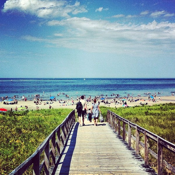
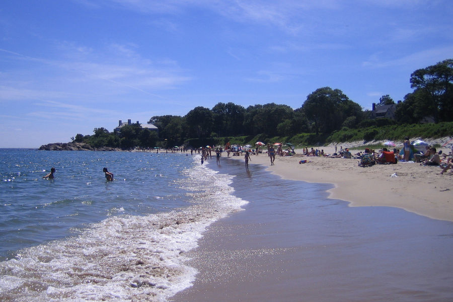
Cranes Beach
Dane Street Beach
Singing Beach
Empire State Building
350 5th Ave, New York, NY 10118
Sample Headline
Sample text. Lorem ipsum dolor sit amet, consectetur adipiscing elit nullam nunc justo sagittis suscipit ultrices.